
Copyright ©APKDroid. All Rights Reserved
Scarica e condividi Aviation Weather - METARs, TAFs, & Flight Planning - v2.0.20201029.01, uno degli elementi in primo piano App nella categoria Meteo.
Inoltre, qualche altro App che puoi scaricare come RainViewer Weather forecast & storm tracker Premium APK Mod Extra MOD APK, Weather XL PRO (MOD, Pro sbloccato) MOD APK, Sense V2 Flip Clock & Weather Premium APK MOD APK, Ob havo o'zbekcha, meteoblue, Weather & Widget Weawow APK sbloccato MOD APK. Se sei soddisfatto di Aviation Weather - METARs, TAFs, & Flight Planning - v2.0.20201029.01.
Rilasciata da Autopilot Studios LLC, Aviation Weather - METARs, TAFs, & Flight Planning - v2.0.20201029.01 è una delle migliori applicazioni gratuite per telefoni cellulari attualmente disponibili. Si trova nella categoria Meteo dell'app store.
Il sistema operativo minimo per Aviation Weather - METARs, TAFs, & Flight Planning - v2.0.20201029.01 è Android 5.0+ e versioni successive. Quindi devi aggiornare il telefono se non l'hai già fatto.
Su APKDroid, riceverai Aviation Weather - METARs, TAFs, & Flight Planning - v2.0.20201029.01 download gratuito di APK, con l'ultima versione 2.0.20201029.01, data di pubblicazione 2020-12-23, la dimensione del file è 26.3 MB.Secondo le statistiche del Google Play Store, ci sono circa 1000 download. Le app scaricate o installate singolarmente su Android possono essere aggiornate se lo desideri. Aggiorna anche le tue app. Ti garantisce l'accesso alle funzioni più recenti e alla sicurezza e stabilità dell'app. Divertiti subito !!!
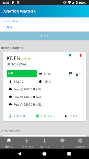
Aviation weather puts information from aviation weather reporting sites at your fingertips! This app allows the easy access of METAR and TAF reports for reporting stations across the globe.
- Save your favorite stations and always know what the weather is reporting.
- Find reporting stations near your current location.
- Create a flight plan and view current and predicted weather for your flight path.
- View PIREP, AIRMET and SIGMET reports along your intended flight path.
- View METAR history and see how the weather has changed over time.
Rebuilt from the ground up. Multiple bug fixes and refined UI.
Show more